
Ormond Beach Neighbors by Block
The best official sources describe land, owners, public acts, and civic roles. They are not a household directory. Begin with the county parcel map for block shape, then open the Property Appraiser detail for each lot. Use permits or city requests for changes at a nearby address. A defined voter-file request can return nonexempt fields, but the self-service voter tool is only for a voter checking his or her own registration.
| Source | What It Shows About a Block | Access |
|---|---|---|
| VCPA ArcGIS parcel map | Parcel shape, site, owner link, aerial and zoning context | Free map browse |
| Surrounding-owner list | Tax owners and mailing addresses near a selected parcel | Free portal function; not a resident list |
| VCPA street-name results | Parcel rows along the named street | Free, with export tools |
| Permit and code records | Dated work or reported issues at nearby addresses | Tyler portal or city request |
| Voter-file extract | Nonexempt registered-voter fields for a defined area | Records request; protected people withheld |
| Civic records | Public board appointees, officers, minutes, and contact points | Public pages; not private membership |
An owner name answers who holds taxable title. It may not identify who occupies the property. A remote mailing address can reflect an absentee owner, trust, estate, manager, or simple mailing choice. A matching situs and mailing address plus a homestead exemption is stronger evidence of owner occupancy, but still does not name each person in the home. Keep that difference clear when researching Ormond Beach neighbors.
Compare Ormond Beach Block Addresses
The site's physical address is called the situs. The tax-mailing address is where notices go. Keep them in separate columns when comparing a block. The parcel's legal description, such as subdivision, block, and lot, is the durable key that links the map to deeds and plats. This matters along the Halifax coast, where an Ormond Beach postal label can refer to land outside city limits.
- Parcel
- A mapped unit of land with its own county identifier.
- Situs
- The physical location assigned to the parcel.
- Mailing address
- The place where the tax office sends owner notices.
- Plat
- A recorded map that lays out lots, blocks, streets, or a condominium.
Condominiums need extra care. Many parcel interests may stack at one building address, while subdivision lots appear as separate shapes. Across-street lots may be part of the visual block without touching the target parcel. Preserve the geometry used for the search so the selected set is consistent.
Map Ormond Beach Neighbor Parcels
The Volusia County parcel viewer supplies the immediate visual frame. Search the target address or parcel and zoom until each boundary is clear. The map offers parcel boundaries, aerial imagery, zoning context, owner links, and a surrounding-owner mailing-list function. County data supports research, but it does not replace a survey or title opinion.
- Locate the known address and record its parcel identifier, situs, and legal description.
- Click each touching parcel. Add lots across the street only if that rule is used for the full block.
- Open each tax detail. Record the owner, mailing address, property class, and exemption facts separately.
- Use permits, plats, deeds, or a lawful voter-file request only when they answer a specific follow-up question.
The process is address to parcel, parcel to adjacent lots, then owner detail and dated supporting records. For every parcel along the full road, use the Ormond Beach street directory workflow instead of expanding a block search without limit.
Ormond Beach Neighbor Voter Records
The Volusia Elections self-lookup is not a street directory. It asks a voter for first name, last name, and date of birth to verify personal registration, precinct, polling place, and district facts. Repeated name attempts are not a valid way to build a block list. A block-level question requires a defined public-record request to the Supervisor of Elections.
Florida voter data may include a name, residence or mailing address, party, precinct, district, registration date or status, and participation history. Participation means which elections a person took part in, never ballot choices. Signatures, Social Security numbers, driver-license or state-ID numbers, and source-agency information receive protection. Full birth dates and exempt addresses are also constrained. Ask for a clear geography, date, fields, and format, then let the custodian apply the exemptions.
Note: Inactive or cancelled registration does not prove that a neighbor moved on a specific day.
Ormond Beach Civic Neighbor Contacts
Community records add public contacts, not private household membership. Ormond Beach has four Commission Zones, which can organize city records but do not define a resident directory. The Neighborhood Improvement program handles code and property-maintenance reports. A reporter must provide a name and address under the rule in effect since July 2021, and supplied identifying details can become public records.
South Ormond Center
176 Division Avenue
386-610-0639
Public programs, not a resident roster.
City Advisory Boards
Planning, preservation, quality-of-life, and parks records identify public appointees and meeting activity.
Local Civic Groups
City parks material names Bear Creek HOA, Kiwanis, Rotary, and Lions in public civic roles.
No authoritative citywide list of HOAs or public membership directories was found. An officer list is not a member roll. Private congregations, clubs, veterans groups, and associations may restrict their records, so ask permission. The Ormond Beach Historical Society and Volusia County Public Library can help locate donated newsletters, minutes, photos, school items, and newspaper clippings when a block has a history question.
Official Ormond Beach Block Evidence
Commercial neighbor tools blend tax, voter, and purchased data. Their links between a person and an address may be stale or wrong. Official sources are narrower, but each has a known custodian and stated purpose. Use commercial compilations only as leads and confirm the result at the office that created the underlying record.
| Source type | Best use | Main limit |
|---|---|---|
| Official parcel roll | Current taxable owner and parcel facts | Not an occupant list |
| Official voter extract | Lawfully released registration fields | Protected records withheld; no ballot choices |
| City permit or civic record | Dated work, public role, or meeting fact | Not a household roster |
| Commercial compilation | Possible lead to verify | May be stale, merged, or misassociated |
Explain Changing Ormond Beach Neighbors
A parcel map is a present-day view. Permits and plats can explain why the block no longer matches an older memory, photo, or directory. Ormond Beach's Tyler Civic Access accepts a street address, parcel number, or permit number. Public details can include application history, status, work scope, owner or contractor, and application, issue, inspection, or final dates. Those dates document work at the property. They do not identify every person living there.
When the online permit result is thin, request the relevant file from the City Building Division or records custodian. Code history may also require a city request because no complete public historic case index was confirmed. A code complaint is dated property evidence, but the city warns that a complainant's supplied name, phone, and report may become public. Staff generally responds through Neighborhood Improvement channels rather than a household directory.
Plats answer a different question. A recorded plat shows the legal layout of lots, blocks, streets, or condominium interests. Pair the plat book and page with the parcel legal description when one street address covers many units or when a visible boundary is unclear. The Property Appraiser's map and data remain research aids, not a survey.
Historic checks need both city names. Older material may index the community as Ormond, while later records use Ormond Beach. Greater Daytona titles can also include Ormond entries. That naming shift, the mainland and beachside split, and the postal reach into Ormond-by-the-Sea can make two nearby records appear to describe different places. Parcel identity and legal description are safer bridges than the mailing-city line alone.
Check Ormond Beach Safety Records
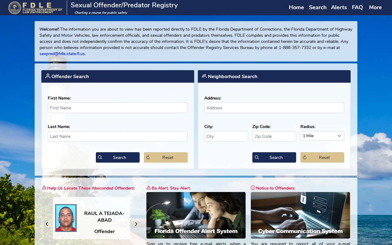
For a specific safety concern, use the official tool built for it. The Florida offender registry supports name and neighborhood searches, with filters for city, county, ZIP, status, and offender type. Results may show a photo, aliases, physical description, address, qualifying offense, status, and address source. The registry warns that fingerprint comparison is required for positive identification.
The official registry screen helps users review its own warnings and filters before interpreting a nearby result.
A mapped address is not permission to contact, confront, or harass the person shown.
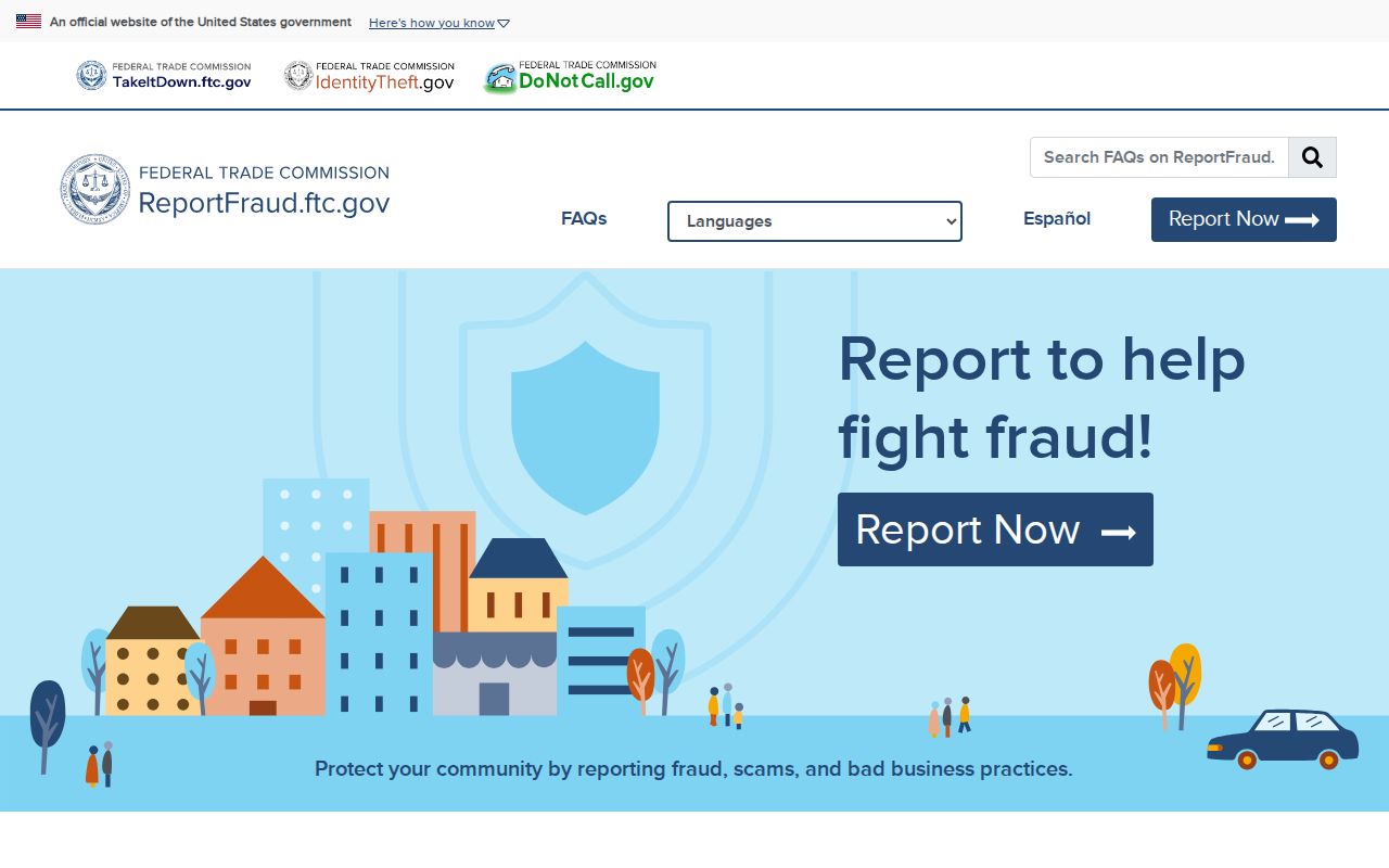
Scam or identity-data misuse can be reported through ReportFraud.ftc.gov, local police, or Florida consumer-protection channels. The federal reporting screen offers a direct path for a documented fraud complaint.
Use an independently verified agency number when a caller or letter claims to concern a warrant, jury duty, deed, or payment.
Ormond Beach Neighbors and Privacy
Renters and unlisted household members do not appear on the owner roll. Private association and congregation membership, utility accounts, and delivery data also fall outside the official block chain. Florida Safe Address can substitute a mailing address for qualified survivors of domestic violence, stalking, and related threats. Section 119.071 adds address and family-information exemptions for listed protected groups.
A person may need to assert an exemption with each custodian. Redaction from one portal does not ensure that every other agency copy changes at once. A missing address may reflect lawful protection, not a search error. Respect that boundary.
Lawful use. Research Ormond Beach neighbors for civic curiosity, reconnection, or personal safety. Never use a record to watch, harass, threaten, or harm another person.
Florida section 784.048 prohibits stalking and cyberstalking. For an emergency, call 911. For a nonemergency concern, use the official local agency channel and provide facts rather than assumptions drawn from a map.